According to the Census Bureau, whose work is responsible for producing the data used to determine Congressional district boundaries, "[e]ach congressional district is to be as equal in population to all other congressional districts in a state as practicable." How states accomplish this varies widely. The federal constitution is silent on the matter, only providing the census as a means of apportioning Representatives among the states, not determining how those representatives are chosen.
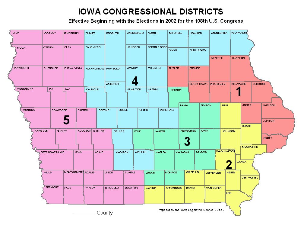
Some states have chosen to use their counties as a means of drawing district boundaries, such as Iowa, shown here:
Oklahoma follows this system as a general rule, although some county lines and Congressional district lines diverge:
And then there's Maryland...
There are those who would argue that the relatively small size, the shape, and large population of Maryland does not lend itself to the tidy and relatively simple configurations achieved by states such as Iowa and Oklahoma. But it is difficult to look at the outcome and not have other images come to mind. Given the recent attention paid to the much reviled MSM (no, not "main stream media" - that other reviled MSM, mechanically-separated meat,) this is the mental picture of the process that I see:
(Hat tip to Tail 'o the Rat for the photo)
Although as the Washington Post helpfully points out, this photo (or I should say the non-rainbow original) is actually mechanically-separated-chicken, but chicken is meat in my book, so there's no need to split hairs.
Otto von Bismarck is credited with observing, "To retain respect for sausages and laws, one must not watch them in the making." I would add "Congressional districts" to the list, but just to be safe, one might not even want to see them when they are done.


No comments:
Post a Comment